On the afternoon of Wednesday, June 25, 2008, kayakers Aaron & Sarah Reedy and Patrick Hanlon arrived in Memphis, Tennessee after 8 days of kayaking on the mighty Mississippi River from St. Louis, Missouri. I, along with James Baker of the Sierra Club and John Gary of the Memphis Yacht Club, went down to greet them and hear about their trip so far.

Aaron & Sarah Reedy are school teachers from Chicago, Illinois. He’s a biology teacher, she’s a history teacher. Patrick Hanlon is an environmental inspector out of Minneapolis, Minnesota. Aaron & Sarah met Patrick while in the Peace Corps in Vanuatu in 2005. After their experiences kayaking there, Sarah thought it would be a great idea to kayak the Mississippi River when they returned to the U.S. They subsequently received a Fund for Teachers Fellowship Program grant for a summer sabbatical which would inspire new teaching ideas for their students. Their scientific focus will be water testing and large woody debris, or snags, though they were not able to study the woody debris for the first 200 hundred miles because of high water. They are updating their blog with details from the trip as they are able, so keep up with their awesome journey there.


They started in St. Louis (30 miles further south than intended due to high flood levels there). It took them 8 days to get to Memphis and they’ve averaged 45 miles per day. They report that paddling has been fine and high water has increased speed some, and that the challenges they faced were in first 200 miles of trip trying to find a place to camp. They’ve been battling with sunburn and poison ivy, but keeping their spirits up. In order to find camping in the first 200 miles of flooding, they had to paddle over flooded boat ramps and into flooded streets to find dry ground. One night they stayed on a beach after cutting through overgrowth with a machete to find a dry patch, and that’s where the poison ivy came in. The water level rose during that night and Patrick even had to get up to move his tent because of the rising river. They said camping became much easier after they passed through the confluence of the Mississippi and Ohio Rivers.
Over the course of their trip thus far they traveled 61 miles on their longest day, and have gotten up to 13 mph at their sprinting speed. They said they averaged a speed of 9 mph when going with the river, and the slowest speeds were between 5-6 mph when they went against headwinds.
They have been collecting MS River water samples along the way and are testing the water for nitrate and phosphate levels, along with dissolved oxygen and temperatures. They reported that they have had some trouble with accurate readings with the nitrate test.

Description of their testing methods and scientific equipment (from their blog):
To measure nutrient pollution and dissolved oxygen in water samples we will be using a Hach DR850 colorimeter. A colorimeter is a piece of equipment that measures the absorbance of light as it passes through a solution. Reagents will be added to each sample to test for nitrates, phosphates and dissolved oxygen. In the presence of these substances the samples will change color and less light will pass through them. The colorimeter will measure how much light passes through the sample and will give a reading for the pollutant being tested in milligrams per liter (mg/L).
The colorimeter basically looks like an oversized calculator with a well towards the top. A glass container, called a cuvette, holds the water sample and gets placed in the well for testing. A cover is then placed over the sample during testing to keep out outside light as the colorimeter passes light through the sample.
For our study of large woody debris, or snags, we will simply be counting and marking the locations of snags in selected sections of river. We will be paddling close to the shore during these counts. The equipment we will be using for the counts will be our eyes, a pencil and notebook, and a handheld water proof GPS unit.

They departed Memphis this morning (June 27th) for New Orleans, with a planned arrival of July 15th. We wish them a successful and safe journey and look forward to hearing about the rest of the trip!
Story and photos by Amie Vanderford
Friday, June 27, 2008
Intrepid Scientific Kayakers
Saturday, June 21, 2008
Geocaching Fun
Listings with GPS coordinates may be found at the below geocaching.com links.
If you don't know what this geocaching is all about, please read what it is here. We warn you, you may get hooked!
Alex Haley House
Covington First Baptist Church
Hunt Phelan House
What is not noted in the listings on geocaching.com is that these caches are also part of a Mississippi River Parkway Commission ten state-wide contest to get people out along the Mississippi River.
As part of the National Great River Road’s 70th Anniversary in 2008, the Mississippi River Parkway Commission is creating a special geocaching event (the contest rules are here).
The "National Great River Road 70th Anniversary Geocaching Event" will feature a series of geocaches created specifically for the 70th Anniversary celebration. Caches will be located throughout each of the ten Mississippi River States. Each of the caches will be historically themed.
Contests, prizes and other fun activities will appeal to geocachers of all ages and levels of geocaching experience.
For more information about the contest, please visit the FAQ.
Important note: In order to enter the contest you must make note of the symbols/icons in the lower right-hand corner of the white info card inside the cache lid.
Monday, June 9, 2008
West Tennessee Tour
On June 6 - 7, 2008, the Mississippi River Corridor - TN staff , along with some professors from the University of Memphis, toured various natural, historical and cultural assets in the 6 counties of West Tennessee that border the Mississippi River.
Duvall Landing in Tipton County: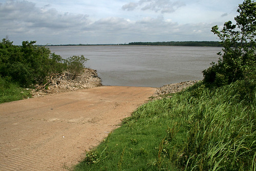
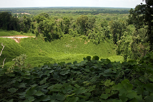
Chickasaw Bluff No. 2 in Tipton County: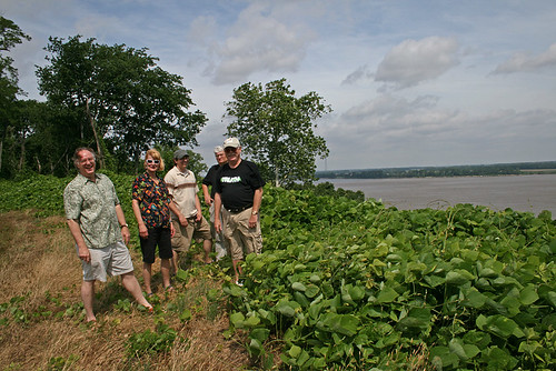
Turnage Grocery in Tipton County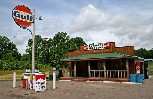
Land by the Mississippi River in Randolph, Tipton County
Henning Deli & Grill in Lauderdale County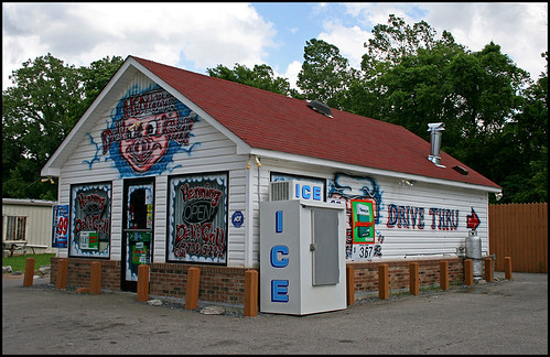
Flippen's Barn in Obion County - they moved their store into Union City. This place has the best fried fruit pies anywhere.
From Fish Gap Hill in Obion County you can see part of Reelfoot Lake.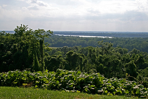
Sunset on Reelfoot Lake
Farmers up and down the six counties had more wheat crops than I recall in the past.
Views from Highway 19 in Lauderdale County, TN: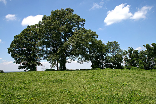

Sandy Beach along the shores of the Mississippi River in Lauderdale County, near Ft. Pillow State Historic Park.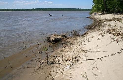
Photography © Amie Vanderford

